DEVELOPMENT PLANNING INSTITUTE OF THE SARAJEVO CANTON

DEVELOPMENT PLANNING INSTITUTE OF THE SARAJEVO CANTON

Development Planning Institute of the Sarajevo Canton, with GAUSS as a partner, has upgraded its information system with the WebGIS component, which enables a visual overview of all relevant information related to the Canton Sarajevo area.

With the integration and centralization of data following spatial documentation was included:
  • Geodetic and topographic-cartographic data
  • Spatial plan of Sarajevo Canton
  • Urbanistic plan of Sarajevo
  • Regulatory plans in Sarajevo Canton
  • Information on license applications (urban, location, construction, use)
  • Metadata.
SARAJEVO INTERNATIONAL AIRPORT

SARAJEVO INTERNATIONAL AIRPORT

Public Enterprise Sarajevo International Airport d.o.o. Sarajevo, in cooperation with GAUSS, centralized all its spatial data and provided access to spatial data of other institutions and organizations; introduced GIS for real-time data presentation, intelligent analysis and full reporting, visualization via online interactive map, as well as data search.

In the framework of the project, a geodetic survey was performed for data validation. As a result of this survey a unique spatial data model was established.

MUNICIPALITY HADŽIĆI

MUNICIPALITY HADŽIĆI

Municipality Hadžići, in cooperation with GAUSS, was the first municipality in Bosnia and Herzegovina that implemented the WebGIS solution on Microsoft Azure cloud platform.

The result is GeoPortal, a solution with all spatial data of interest for municipal officials, integrated with databases of higher level institutions: cantons and federation.

CITY OF MOSTAR

CITY OF MOSTAR

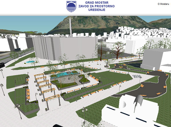
Institute for Spatial Planning of City Mostar in cooperation with GAUSS implemented geographical system for the entire organization, which consists of collecting data (orthophoto and LiDAR recording), central database establishment (Oracle), web presentation of data (GAUSS WebPresenter) and complete document management (GAUSS UrbanPlanner).

TOMTOM

TOMTOM

TomTom is a global leader in navigation, traffic and cartographic products, GPS sports watches and fleet management solutions.

GAUSS, as a partner of TomTom, has prepared all spatial data of Bosnia and Herzegovina. On these data rely both domestic and international institutions, and individuals, for planning, analysis and reporting on the Bosnia and Herzegovina territory.