Epidemic Location Intelligence System (ELIS)

Epidemic Location Intelligence System (ELIS)

Project Title: Epidemic Location Intelligence System (ELIS) – expert system for monitoring and prevention of  the spread COVID-19
Duration: April 2020 – April 2022
The subject of the research is the spatial and temporal monitoring, analysis and prediction of the spread of COVID-19 in Bosnia and Herzegovina through:
  • collection of epidemic and other data for monitoring the outbreak and its spread,
  • biostatistical analysis of the rate of spread and spatio-temporal distribution of infection,
  • analysis of the epidemic surveillance system, and proposing measures for its improvement,
  • informing the competent institutions about the epidemic situation and the effects of control measures,
  • evaluation of epidemic data through active serological surveillance and
  • centralization and exchange of biostatistical and other data for research projects.
The aim of the project is to provide information relevant to epidemic surveillance in Bosnia and Herzegovina, as well as a research database for other complementary and interdisciplinary projects.
ERASMUS+ GEOBIZ – Business driven problem-based learning for academic excellence in geoinformatics

ERASMUS+ GEOBIZ – Business driven problem-based learning for academic excellence in geoinformatics

The main aim of the GEOBIZ project is strengthening the capacity of academic institutions to better respond to the needs of the emerging geoinformatics industry in Albania, Bosnia and Herzegovina, Kosovo, Moldova and Montenegro with emphasis on the following aspects:

  • Establishing new and innovative forms of business-academia cooperation to support interaction in teaching/learning processes in geoinformatics.
  • Establishment of business-academia platform supporting excellence in geoinformatics.
  • Developing innovative teacher training programs and practical teaching/learning methodologies and content in technology-based courses in geoinformatics leaned on business-driven needs and experience.
  • Implementing state-of-the art techniques in geoinformatics teaching process.


More information: official pages

FEDERAL ADMINISTRATION FOR GEODETIC AND REAL PROPERTY AFFAIRS OF FBIH

FEDERAL ADMINISTRATION FOR GEODETIC AND REAL PROPERTY AFFAIRS OF FBIH

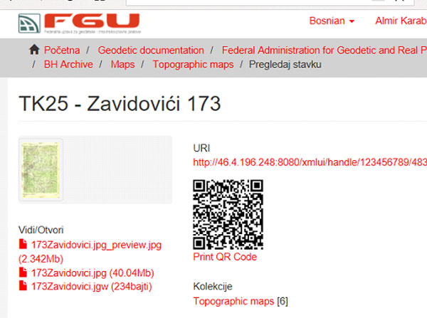
Federal Geodetic Administration and GAUSS have a fruitful cooperation that has been going on for 18 years on numerous projects, of which only a few are highlighted:

  • Digitalization of data (scanning, georeferencing and vectorization)
  • Creation of Real Estate Cadastre Database (BPKN)
  • Establishment of a unified Cadastre software for the Federation of Bosnia and Herzegovina (FBiH); and maintenance of one third of the office in FBiH (www.katastar.ba)
  • Creation of a database of geodetic points with a web interface
  • Services for harmonization of data on real estate between the Cadastre and Land Registry in FBiH done on the project of real estate registration (harmonization)
  • Creation of a Digital Archive information system for Federation of Bosnia and Herzegovina
FEDERAL BUREAU OF STATISTICS

FEDERAL BUREAU OF STATISTICS

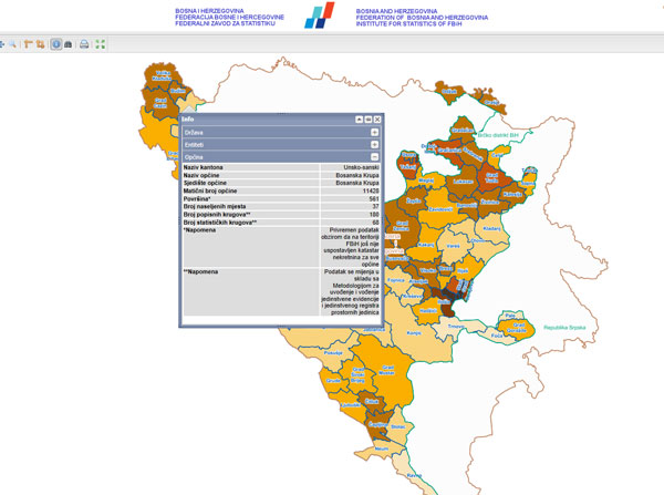
The Federal Bureau of Statistics has put into operation the Web GIS portal in cooperation with GAUSS.

Within the project, an upgrade of the existing infrastructure was carried out, as well as the implementation of a web based geographic information system for the analysis and visualization of spatial data, statistical surveys and censuses of population and households in FBiH. GAUSS WebPresenter platform and Oracle Spatial technology were used in this project.
The result of this project is the provision of an IT infrastructure for working with spatial data, which includes:

  • Implementation of an information system for input, control and processing of census and statistical data into a central database that ensures efficient storage and use of data.
  • Linking the geographic part of the system to the central database, as well as its development for data visualization – an effective and comprehensible graphical representation of data.
CORPORATION FOR PRODUCTION AND TRANSPORTATION BH-GAS

CORPORATION FOR PRODUCTION AND TRANSPORTATION BH-GAS

The project “Introduction of a unique GIS system for the Corporate society for production and transportation BH-Gas d.o.o. Sarajevo” resulted in the centralization of all spatial data and access to spatial data of other institutions and organizations. Also, it included a real-time data presentation, intelligent analysis and full reporting, visualization via an online interactive map, as well as data search.

By establishing the GeoInformation system and forming a single database, rationalization, integration and optimization of decision making in several sectors have been achieved; as well as more efficient data exchange within the whole society.
By integrating data into a unified GIS, preconditions for better quality management of space and environment, decision making, implementation of laws and regulations from the field have been created.